Acquisition: early topographic manuscript map of southeast Sumatra
Thanks to the financial support of our friends foundation (Stichting Vrienden van de Universitaire Bibliotheken Leiden) Leiden University Libraries was able to purchase a very early topographic map of southeast Sumatra.
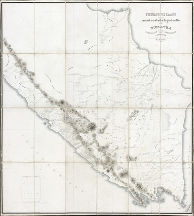
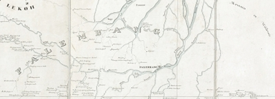
This manuscript map reflect the results of the first topographic survey of southern Sumatra, compiled from data of military expeditions in the 1820s and 1830s, partly under command of captain Willem Louis de Sturler who also compiled this map. This region was never mapped before with a comparable level of detail, accuracy and large scale (ca. 1:400,000). Of this map, only one later hand drawn copy from 1856 is known, kept in the archive of the Ministry of Colonies in the National Archives in The Hague. According to the design and the way of lettering that almost equals printed type font, the map probably was meant to be published in print. The representation of relief, rivers and coastlines indicate the hand of a steady hand of a talented draughtsman.
The map bears the title Figurative kaart van het zuid oostelÿk gedeelte van Sumatra bevattende Palembang, Benkoelen en de Lambongs. Drawn in ink and watercolour, the map originally was divided in six sheets and mounted on linen in 24 segments. The size of the map is approximately 154 x 139 centimeter.
Important addition to the collection
This map is an important addition to the collection of colonial cartography. With the inheritance of the map collections of the Royal Tropical Institute (KIT) and the Royal Netherlands Institute for Southeast Asian and Caribbean Studies (KITLV), Leiden University Libraries hold one of the most important cartographic collections in the field of the (former) Dutch colonies. Another strength in the map collections is the number of manuscript maps.